153 countries
(and areas)
 - Azerbaijan
- Bahrain
- Barbados
- Belgium
- Belize
- Benin
- Bhutan
- Bolivia
- Bonaire
- Bosnia and Herzegovina
- Botswana
- Brazil
- British Virgin Islands
- Brunei
- Bulgaria
- Cambodia
- Canada
- Cape Verde
- Chile
- China
- Costa Rica
- Croatia
- Cuba
- Curacao
- Cyprus
- Czech Republic
- Denmark
- Dominica
- Dominican Republic
- Egypt
- El Salvador
- England
- Estonia
- Eswatini (Swaziland)
- Ethiopia
- Fiji
- Finland
- France
- French Guiana
- Georgia
- Germany
- Gibraltar
- Greece
- Grenada
- Guadeloupe
- Guatemala
- Honduras
- Hong Kong
- Hungary
- Iceland
- India
- Indonesia
- Iran
- Ireland
- Israel
- Italy
- Jamaica
- Japan
- Jordan
- Kazakhstan
- Kenya
- Kosovo
- Kuwait
- Kyrgyzstan
- Laos
- Latvia
- Lebanon
- Lesotho
- Liechtenstein
- Lithuania
- Luxembourg
- Macau
- Madagascar
- Malawi
- Malaysia
- Maldives
- Malta
- Martinique
- Mexico
- Moldova
- Monaco
- Mongolia
- Montenegro
- Morocco
- Mozambique
- Namibia
- Nepal
- Netherlands
- New Zealand
- Nicaragua
- North Macedonia
- Northern Ireland
- Norway
- Oman
- Pakistan
- Palestine
- Peru
- Philippines
- Poland
- Portugal
- Qatar
- Republic of Korea
- Romania
- Russia
- Saint Kitts and Nevis
- Saint Lucia
- Saint Martin
- Saint Vincent and the Grenadines
- San Marino
- Saudi Arabia
- Scotland
- Senegal
- Serbia
- Singapore
- Sint Maarten
- Slovakia
- Slovenia
- South Africa
- Spain
- Sri Lanka
- Suriname
- Sweden
- Switzerland
- Tajikistan
- Tanzania
- Thailand
- The Gambia
- Tibet
- Togo
- Transnistria
- Trinidad and Tobago
- Tunisia
- Turkey
- Turkmenistan
- Uganda
- United Arab Emirates
- United States
- Uruguay
- Uzbekistan
- Vatican City
- Vietnam
- Wales
- Zambia
- Zanzibar
- Azerbaijan
- Bahrain
- Barbados
- Belgium
- Belize
- Benin
- Bhutan
- Bolivia
- Bonaire
- Bosnia and Herzegovina
- Botswana
- Brazil
- British Virgin Islands
- Brunei
- Bulgaria
- Cambodia
- Canada
- Cape Verde
- Chile
- China
- Costa Rica
- Croatia
- Cuba
- Curacao
- Cyprus
- Czech Republic
- Denmark
- Dominica
- Dominican Republic
- Egypt
- El Salvador
- England
- Estonia
- Eswatini (Swaziland)
- Ethiopia
- Fiji
- Finland
- France
- French Guiana
- Georgia
- Germany
- Gibraltar
- Greece
- Grenada
- Guadeloupe
- Guatemala
- Honduras
- Hong Kong
- Hungary
- Iceland
- India
- Indonesia
- Iran
- Ireland
- Israel
- Italy
- Jamaica
- Japan
- Jordan
- Kazakhstan
- Kenya
- Kosovo
- Kuwait
- Kyrgyzstan
- Laos
- Latvia
- Lebanon
- Lesotho
- Liechtenstein
- Lithuania
- Luxembourg
- Macau
- Madagascar
- Malawi
- Malaysia
- Maldives
- Malta
- Martinique
- Mexico
- Moldova
- Monaco
- Mongolia
- Montenegro
- Morocco
- Mozambique
- Namibia
- Nepal
- Netherlands
- New Zealand
- Nicaragua
- North Macedonia
- Northern Ireland
- Norway
- Oman
- Pakistan
- Palestine
- Peru
- Philippines
- Poland
- Portugal
- Qatar
- Republic of Korea
- Romania
- Russia
- Saint Kitts and Nevis
- Saint Lucia
- Saint Martin
- Saint Vincent and the Grenadines
- San Marino
- Saudi Arabia
- Scotland
- Senegal
- Serbia
- Singapore
- Sint Maarten
- Slovakia
- Slovenia
- South Africa
- Spain
- Sri Lanka
- Suriname
- Sweden
- Switzerland
- Tajikistan
- Tanzania
- Thailand
- The Gambia
- Tibet
- Togo
- Transnistria
- Trinidad and Tobago
- Tunisia
- Turkey
- Turkmenistan
- Uganda
- United Arab Emirates
- United States
- Uruguay
- Uzbekistan
- Vatican City
- Vietnam
- Wales
- Zambia
- Zanzibar


Copyright 2004 - 2026
Veeronline.nl Travel Adventures
Home > Netherlands > Discovering Northern Netherlands > Travelogue day 10
Travelogue Discovering Northern Netherlands
June 20 July 4 2021 (15 days)
Netherlands > Cycling on Schiermonnikoog
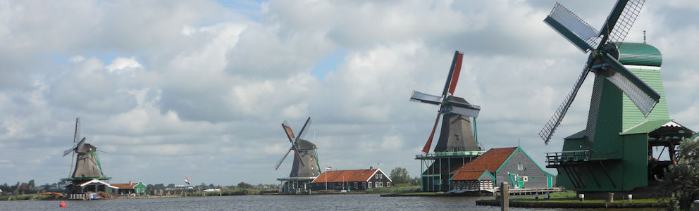
Dag 10 - Tuesday 29 June 2021It rains heavily during the night. The forecast for today isn’t very good—too bad, because we’re planning a day trip to Schiermonnikoog. Over breakfast, we check the latest weather report. It turns out a low-pressure area is sitting right over Friesland, and all the showers seem to be circling around Schiermonnikoog. Maybe it won’t be so bad? We decide to go for it and cycle to the ferry. The showers might hold off, but a strong north wind is blowing over the dike. It takes some serious pedaling to reach Lauwersoog. We arrive at the harbor well before departure and buy our ferry tickets. It doesn’t seem too busy. We take seats on the upper deck, watching Lauwersoog grow smaller behind us. The ferry sails through the channel between the sandbanks. On one of them, a seal is sunbathing—what a nice surprise! Forty-five minutes later, the boat docks at Schiermonnikoog’s harbor. Schiermonnikoog is a relatively small island—just sixteen kilometers long from west to east. The island has only one village, also called Schiermonnikoog, located three kilometers from the harbor. We cycle along the dike and the mudflats to the center.

Birds are foraging on the mudflats, and the tide is slowly coming in. More ferry passengers seem to have the same idea as we do. Like many other tourists, we order coffee on the terrace of Hotel Graaf Bernstorff. Until the Second World War, the island was privately owned. After the war, it became property of the Dutch state. Right next to the terrace stand two enormous whale jawbones, arranged as an arch. They came from a whale caught by Klaas Visser, captain of the expedition ship Willem Barendsz, in 1946. Schiermonnikoog played an important role in whaling. Since the 1960s, whaling has ceased because it was no longer profitable. Our cycling route starts opposite the whale arch and the Willemshof behind it, heading westward. The Westerplas is a freshwater lake on the island where many birds come to breed. From the birdwatching hut, we look out over the water. We then cycle to the eastern side of the island, where the Knobbeduin is located—one of Schiermonnikoog’s highest dunes. On a clear day, you can see both the North Sea and the Wadden Sea from the top. Today, however, it’s cloudy and hazy. The bike path to Badstrand is closed due to construction work. It feels a bit awkward that other cyclists still go through, but we take a detour. Passing the duck decoy Kooiplaats, we reach the Wasserman bunker, which played an important role in the German defense of northern Netherlands during the Second World War.

It was built to house a radar installation, though it was never actually placed. Via Badstrand, we head to the red lighthouse of Schiermonnikoog. Standing 44 meters tall, it has been guiding ships since 1853. Around three o’clock, we’re back in the village of Schiermonnikoog. While sitting on a terrace, we notice it’s getting cooler and windier. So far, we’ve had a dry day, but that seems about to change. We quickly cycle back to the ferry, and on the way it starts to drizzle lightly. This time, we take seats inside. The ride back to Anjum is much easier than this morning—we’re cycling with the wind. The speedometer shows we’re cruising above 30 kilometers per hour along the dike. What a difference from the way there! In Oostmahorn, on the shore of the Lauwersmeer, we stop for dinner. Of the three restaurants, two are closed on Tuesdays. The third is a small, simple place, and luckily there’s one table left. It’s a perfect spot for a meal and to warm up a bit. After dinner, it’s just a ten-minute ride along a bike path through the fields back to Anjum.
 One of the 85 bunkers on Terschelling Island
 St Michaels Church in Woudsend
 On a terrace in Appingedam with a view of the hanging kitchens
 The monumental station dating from 1896
Travelogue Discovering Northern Netherlands
Dag 2 | Netherlands > The Eleven Alley Tour
Dag 3 | Netherlands > From Stavoren to Workum
Dag 4 | Netherlands > The Brekken Path
Dag 5 | Netherlands > Harlingen and Terschelling
Dag 6 | Netherlands > Touring Terschelling
Dag 7 | Netherlands > The Oldest Planetarium
Dag 8 | Netherlands > Boating through Alde Feanen
Dag 9 | Netherlands > View over the Lauwersmeer
Dag 10 | Netherlands > Cycling on Schiermonnikoog
Dag 11 | Netherlands > The Groninger 'Wierde” Villages
Dag 12 | Netherlands > Climbing the Martini Tower
Dag 13 | Netherlands > The Hanging Kitchens
Dag 14 | Netherlands > Dutch History
Dag 15 | Netherlands > House in Wedde